AI-powered radar integrating continuous wave, MIMO imaging and differential interferometry, achieving sub-millimeter to 1mm high-precision non-contact monitoring with AI intelligent early warning and 3D visualization

The AI Slope Deformation Monitoring Radar is a cutting-edge monitoring system designed for real-time terrain and structure deformation detection across multiple industries including mining, railways, and water conservancy.
Integrating Continuous Wave radar technology, MIMO imaging, and Differential Interferometry, this system delivers unprecedented precision in deformation measurement with intelligent early warning capabilities.
The system features a 120° wide-angle monitoring capability with a range of 0.6-6km, supporting all-weather operations with IP66 protection. The AI-driven platform provides real-time 3D visualization and automatic report generation.
Achieves sub-millimeter to 1mm deformation measurement accuracy for critical infrastructure monitoring
Advanced MIMO radar technology for comprehensive terrain imaging and deformation mapping
Multi-level intelligent early warning system with real-time risk assessment and alert management
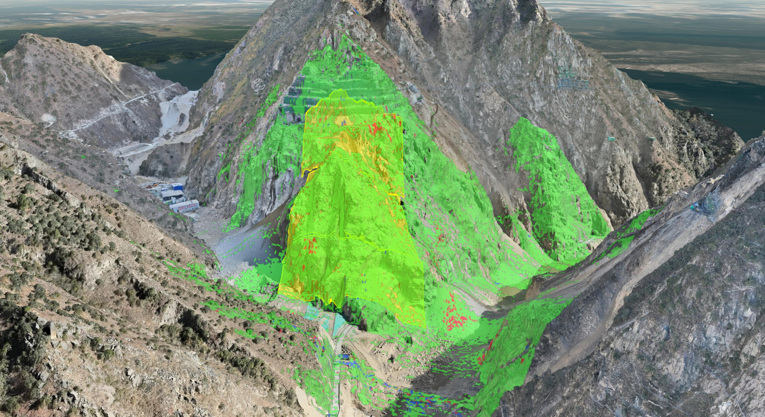
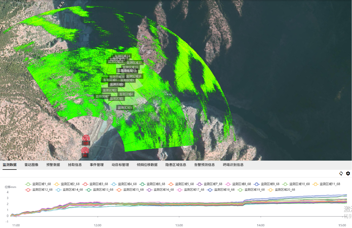
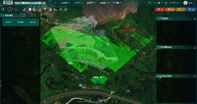
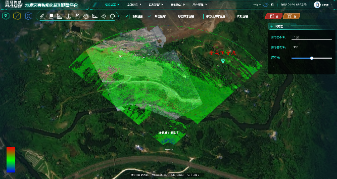
Real-time 3D terrain visualization and deformation mapping for comprehensive monitoring
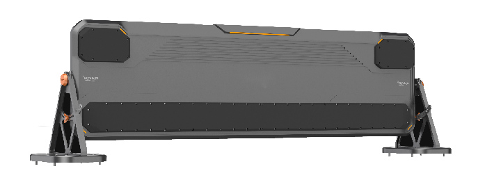
Core radar processing unit with integrated MIMO antenna array for high-precision terrain imaging
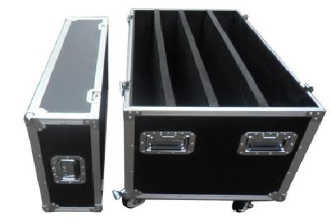
Compact, rugged portable cabinet with integrated power supply and data processing capabilities
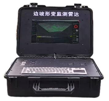
High-performance computing platform for real-time data processing and AI analysis
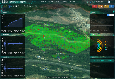
Comprehensive analysis and early warning platform with multi-level alert management
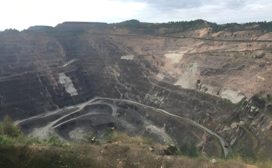
Slope Stability Monitoring: Real-time monitoring of open-pit mine slopes to prevent catastrophic failures
Blast Vibration Analysis: Track deformation caused by blasting operations for safety compliance
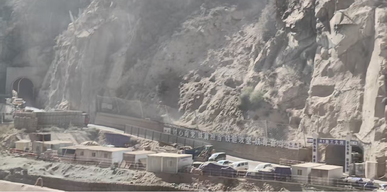
Embankment Monitoring: Continuous monitoring of railway embankments for early deformation detection
Tunnel Convergence: Measure tunnel wall convergence during construction and operation
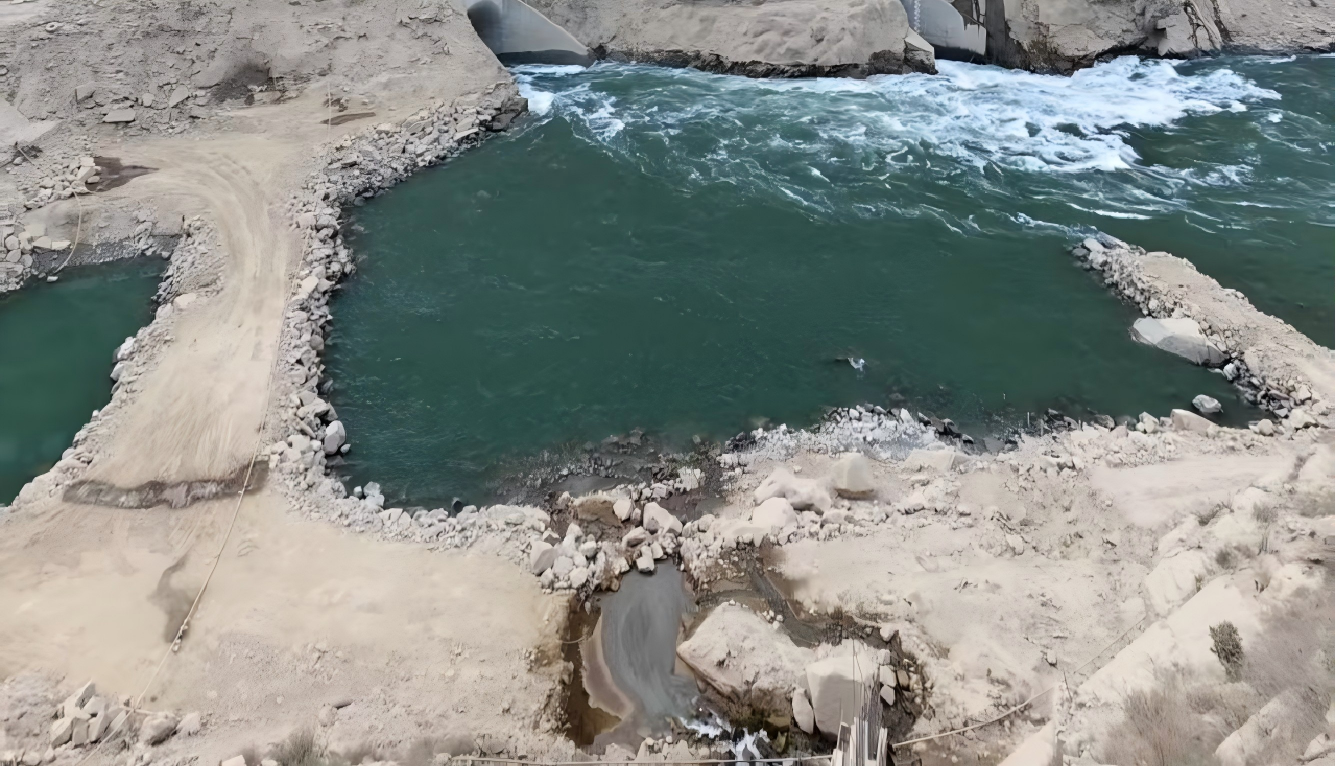
Dam Deformation: Monitor dam wall deformation with sub-millimeter precision
Reservoir Slope: Track reservoir bank slope stability for safe water storage
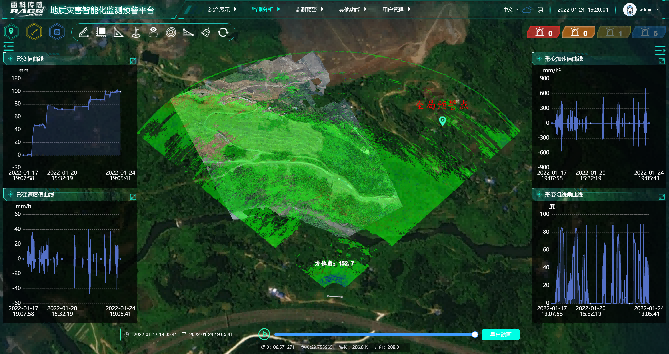
Real-time 3D terrain visualization with deformation mapping and temporal analysis
Configurable alert thresholds with multiple warning levels for different risk scenarios
Connect multiple sensors including rainfall, water level, and crack sensors for comprehensive monitoring
AI-powered algorithms for accurate deformation source analysis and prediction
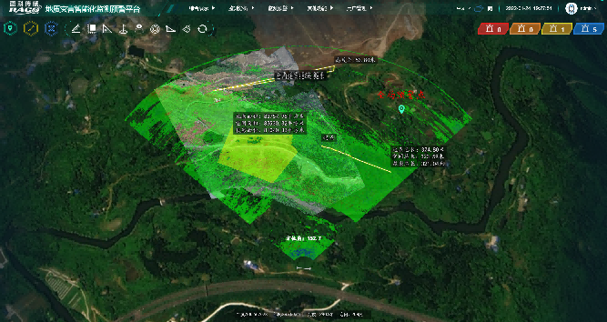
Multiple measurement modes including area masking, volume calculation, visibility analysis
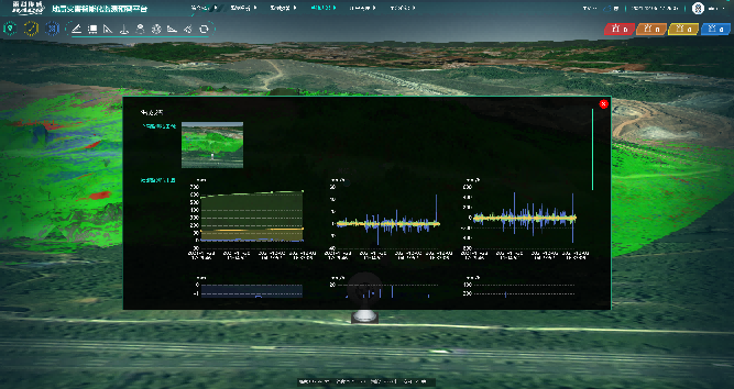
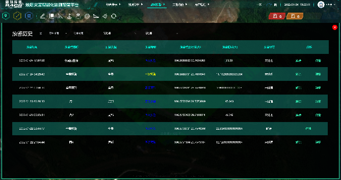
Automated monitoring report generation with comprehensive data analysis and recommendations
Advanced continuous wave radar enables real-time, non-contact monitoring of terrain deformation with high accuracy and reliability in various environmental conditions.
Multi-input multi-output radar imaging provides comprehensive terrain mapping with enhanced resolution and reduced measurement time for large-scale monitoring areas.
Advanced differential interferometric techniques enable precise deformation detection by analyzing phase differences between multiple radar measurements over time.
Machine learning algorithms process complex radar data to extract meaningful deformation patterns, providing accurate risk assessment and predictive analytics for infrastructure safety.

Contact us to learn more about the AI Slope Deformation Monitoring Radar's technical details and application cases
Contact Us DY
DY